
Mansaslu Circuit Trek
Getting there
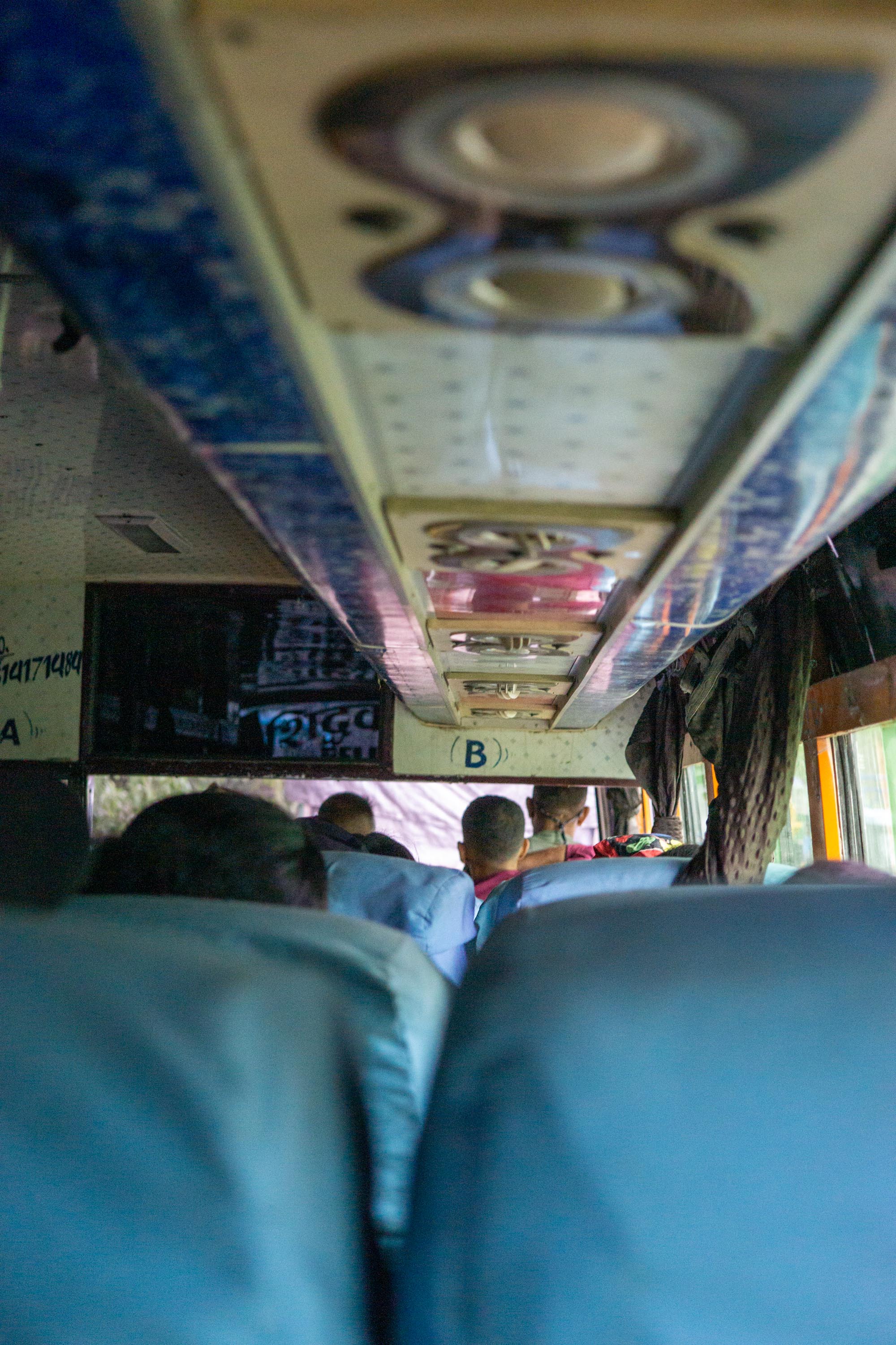
On the 25th of August, after hectic set of days finding the right permits and a guide, I found myself glumly bouncing through the Nepali country side heading towards the Manaslu massif. I say glum only because the road was badly worn down from the rainy season which both made for a rougher ride and meant instead of taking 8 hours, the ride took upwards of 10 hours. Pretty impressive what the bus was able to go through - definitely places where the mud on the road as more than knee deep. The ride certainly helped me to see why it is strictly forbidden to rent a car in Nepal as a foreigner.
Beta and Expectations
Manaslu is a restricted area, so all foreigners heading there need to be accompanied by a guide. From a risk standpoint, I was not quite sure exactly what to expect and wandering into a remote area of a foreign country without knowing the language seemed like a patently poor idea, if not entirely out of character. The plan was to take the bus until the end of the road, in a town called Soti Khol , in the Gorhka region and then walk along the Buri Gandaki until we reached its glacial source. Then I would go over Larkya La pass and descend into Manang and the Annapurna Conservation Area, before flagging down a jeep back to urbanization. It was super early season and I dramatically under estimated the risk of rain, clouds, and high wind. In retrospect, entirely on par for a backpacking trip of mine. One of the major upsides is that there are little towns all along the way so I did not have to carry a tent or food. I however made the exceptionally poor choice of carrying my laptop so that I would be able to apply for my Rwandan visa and responded to emails as needed. I of course, neither replied to emails nor applied for a visa, but lugged an extra 6 pounds for a hundred miles and up a 17 thousand food pass - character building.
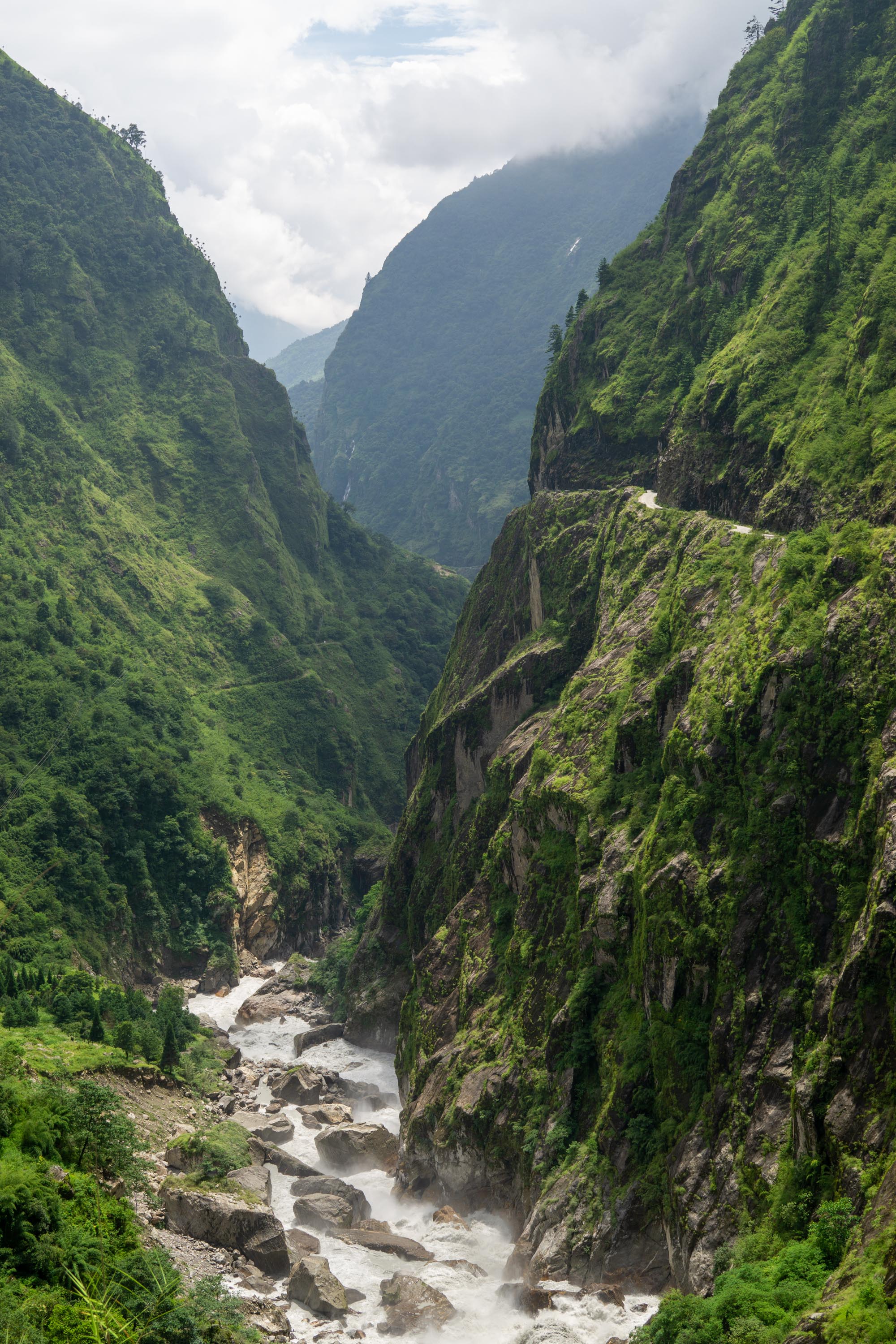
Soti-Khola to Dobhan
There was a bridge out on the road to Soti-Khola, so we walked the last few miles to the town proper. Its has a bit of a frontier/outpost vibe to it . On a gravel bar in the river, there were a ton of supplies, including oxygen tanks, that were a little bit of a mystery to me. Note that there are a lot of towns and places named khola - just means a small river in Nepali. There is this bridge (pictured) that has no road leading to it, its clearly not a pedestrian bridge, but I guess is aspirational infrastructure. Like a lot of infrastructure here, it was built by the Nepalese army. The army is currently replacing the trekking trail with a a jeep track.
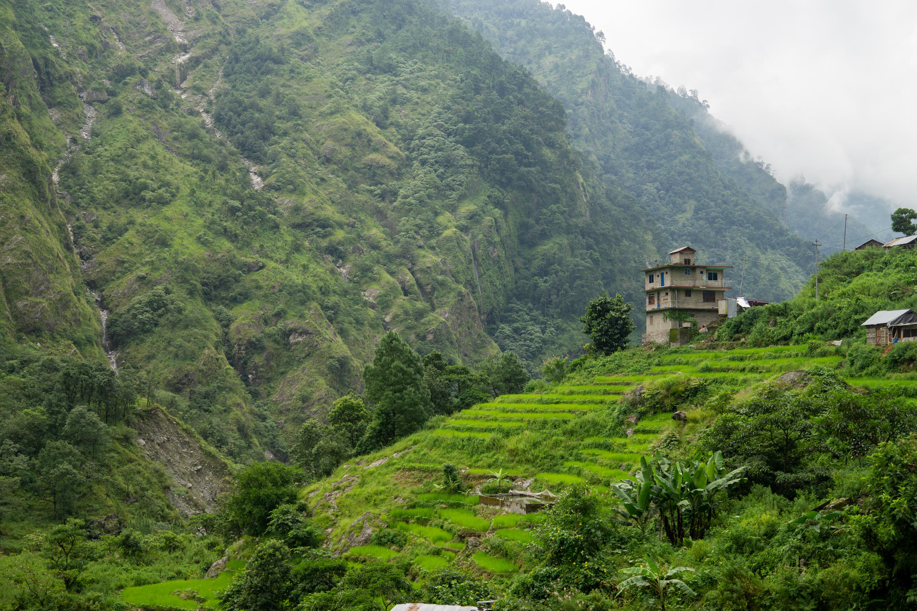
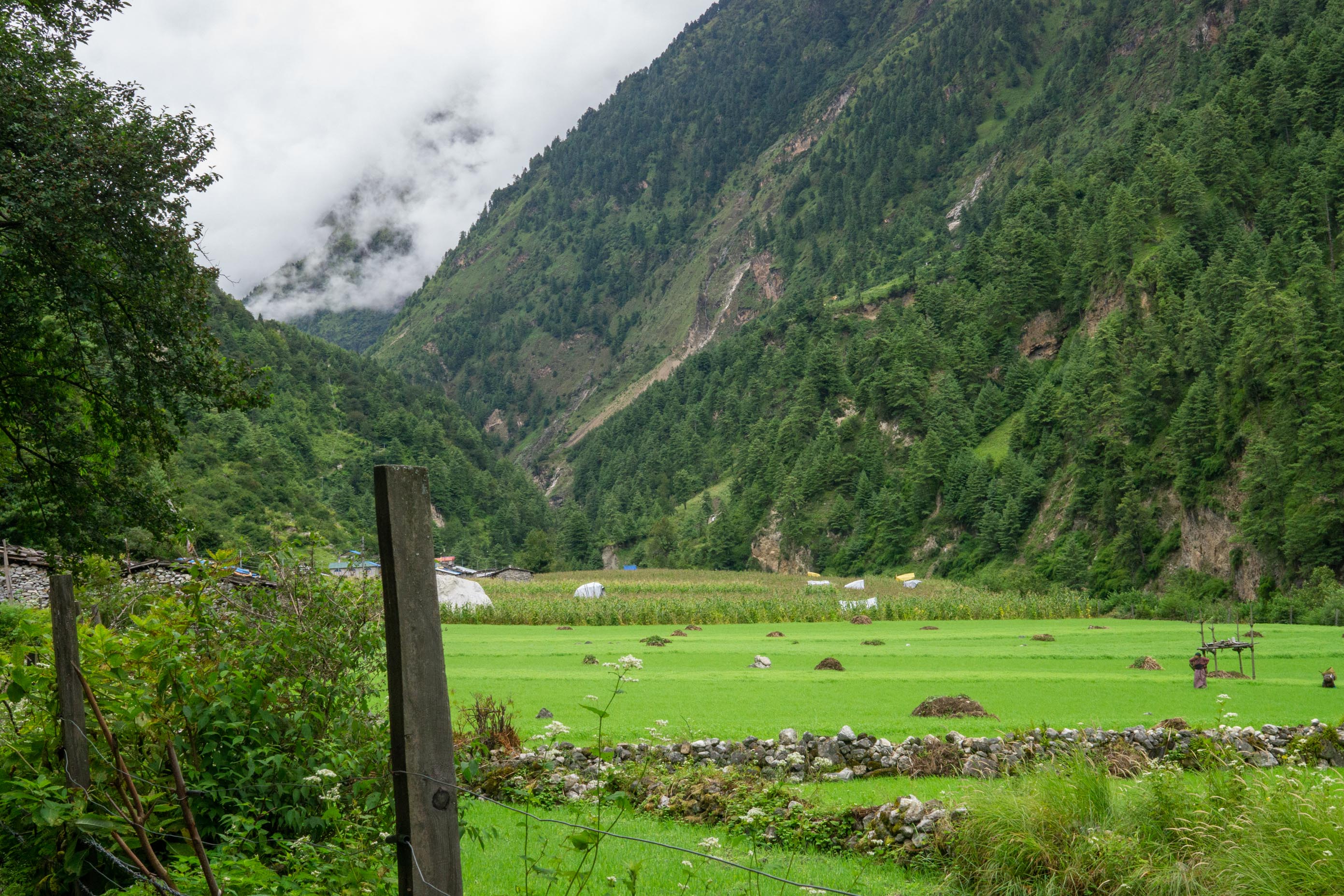
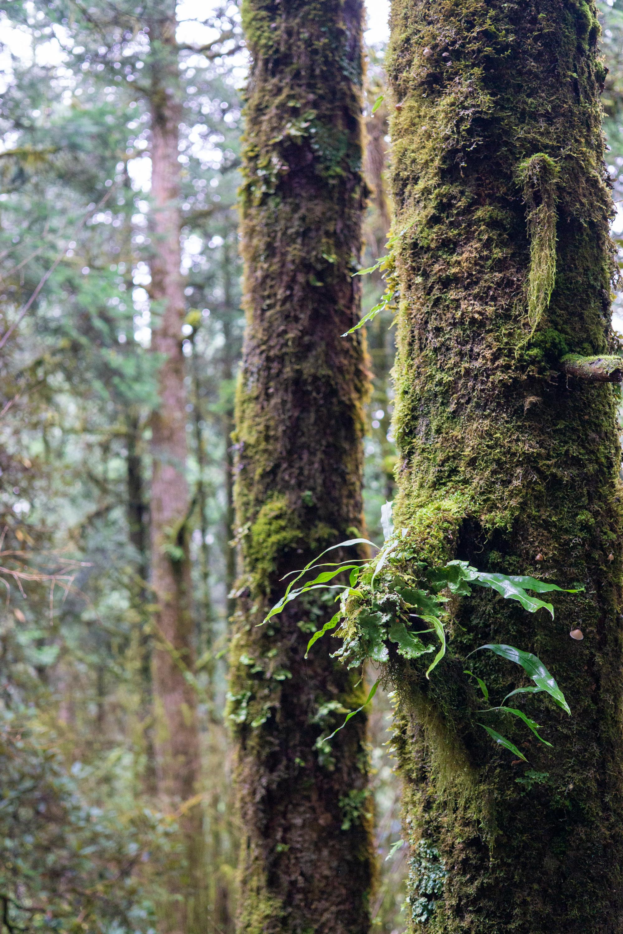
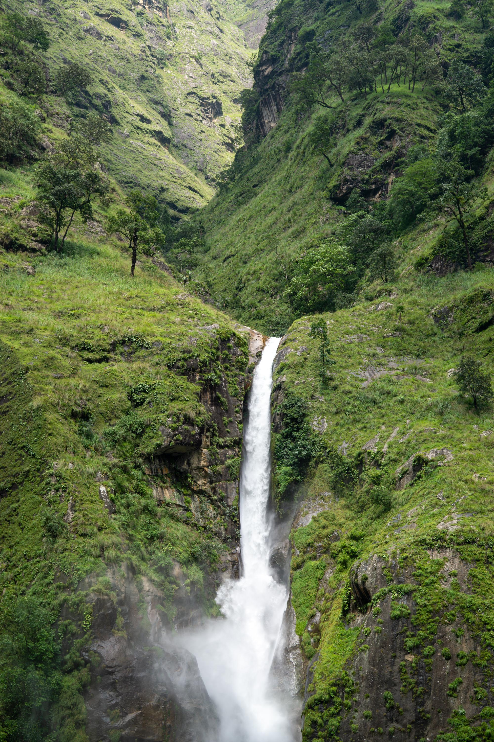
We walked about 10 miles to Dobhan. Most of these towns tend to be seasonal, with the families that live in them moving back to Kathmandu when the harvest is done. The lower elevations here are steep cut into the classic river-formed V and covered in terraced rice fields. Some of the terraces are perched impossible high up. Other staple crops seem to be corn, absolutely enormous cucumbers, and pumpkins. It was hot, humid, and rainy trekking today but the upside of this is that the hill sides were incredibly green and the waterfalls were pouring.
While walking there were frequent helicopters over head. They were ferrying supplies from Soti-Khola, to the base camp for Manaslu. It is probably much faster than employing mule trains, the other optional for transporting goods. But it’s still odd to see turbine helicopters flying frequently over rice paddies that are still tilled by hand.


Dobhan to Philim
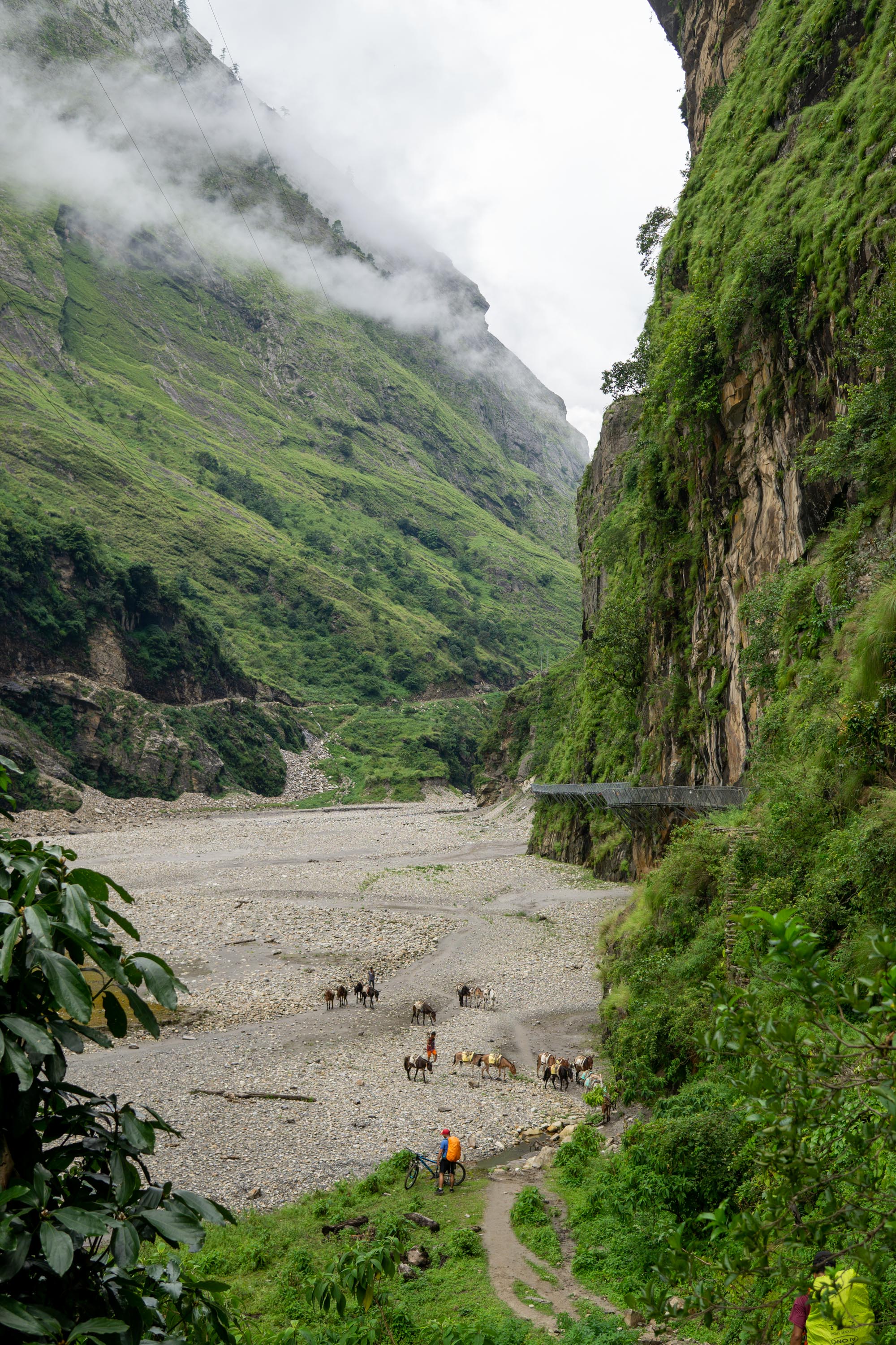
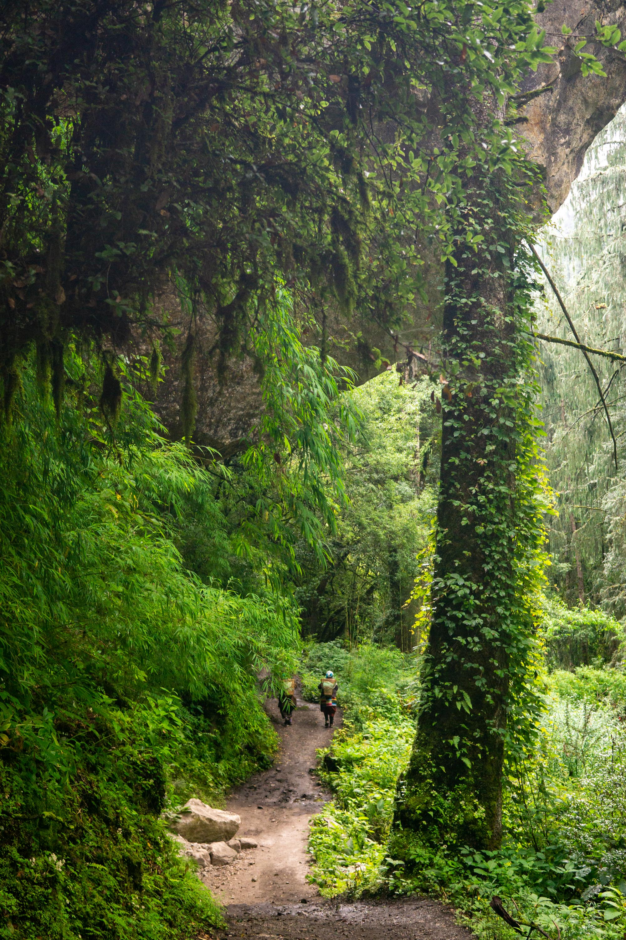
More rain and a ton of waterfalls. The track that we had been following slowly disappeared, after getting rougher and rougher. There were a ton of mule trains, and since the trail runs through the center of towns, the mules must go through the center of time. I stopped for lunch in a town called Jagat, and while I was eating one such train, of probably 30-40 mules came through the village. All the mules have bells on them so as the mules. The trail is often quite narrow and I felt lucky to not get kicked by a mule. Each town seems to have a founder population of dogs, with all the dogs being of one type and limited to no cross-over between the villages. The two dominant types are a small white dog with shaggy fur somewhere between a corgi and Samoyed had offspring and a larger black and tan dog that lies between an Entlebucher and a shepherd.


Philim to Ghap
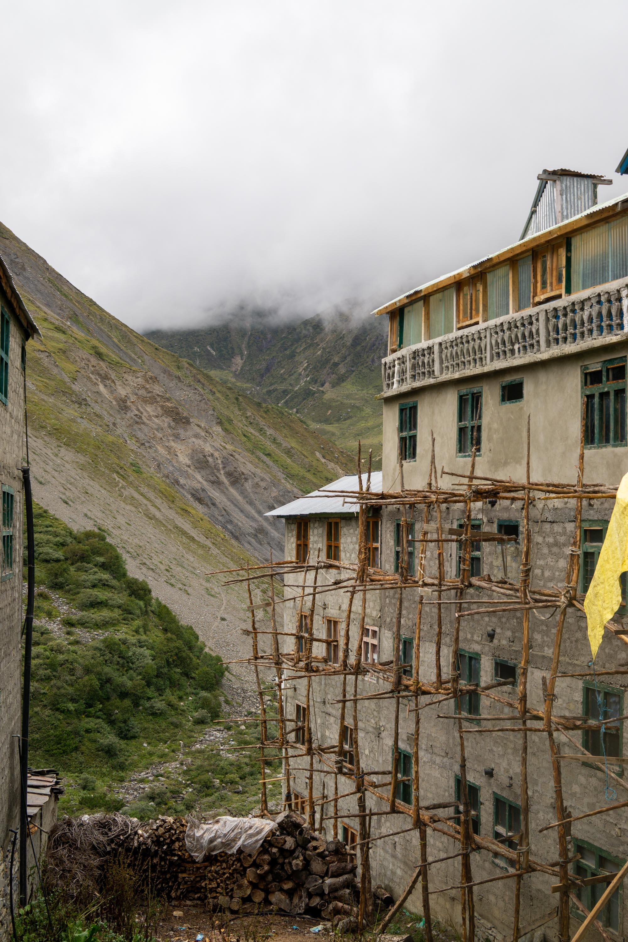
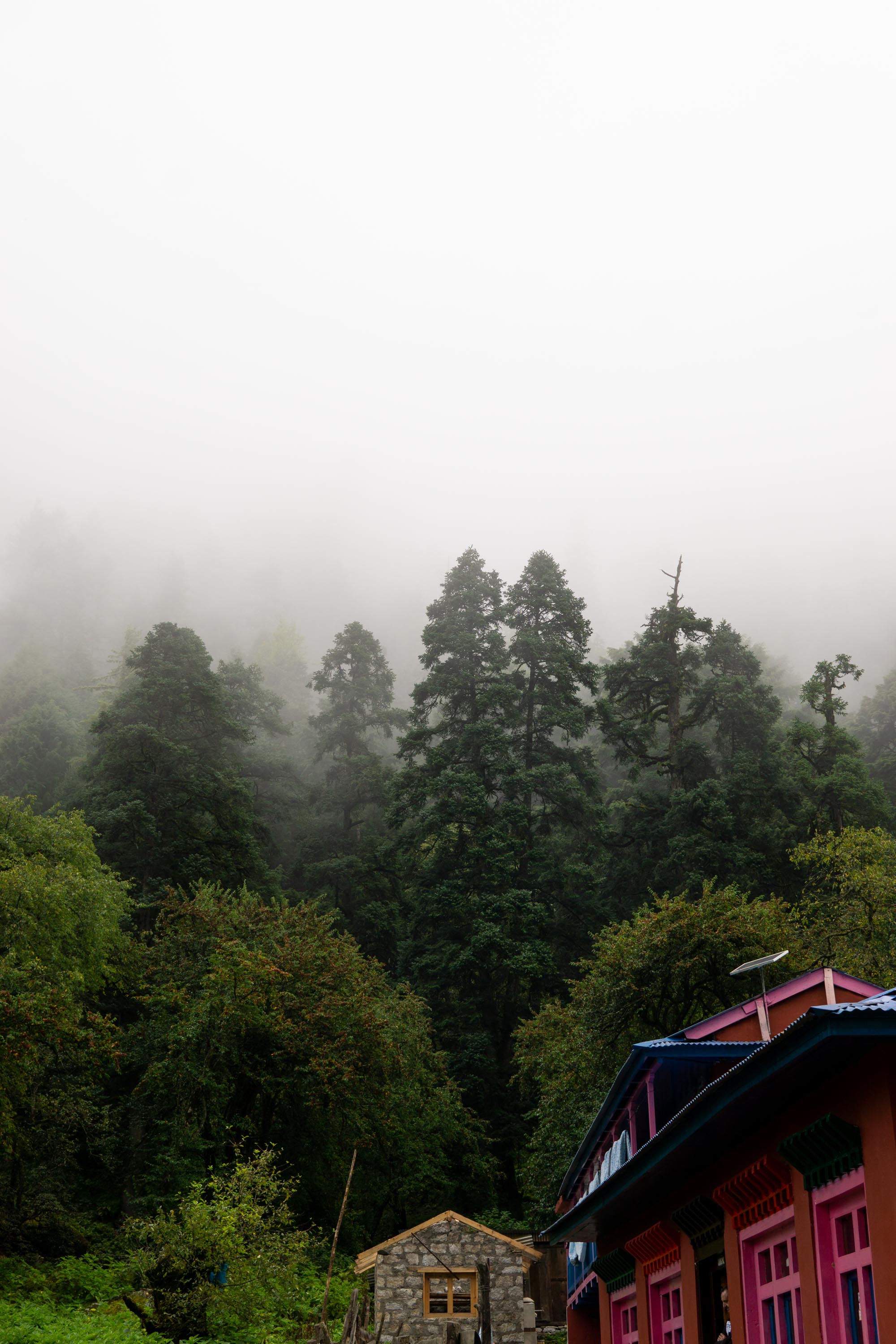
I had not planned to go this far, but was operating along the premise of what I do today I will not have to do tomorrow. Philim felt like it could not quite decide if it was part of the jungle or not. By the time I got to Ghap, the weather had cooled and the rice paddies had largely disappeared. The inn that I was staying at. Ghap sits in the valley below Himchuli – but because of the rain and fog, I could only see its base, which was still very intimidating sheer stone cliffs. From a healthcare perspective, Ghap also had the first clinic of the trip, but it did not seem to be staffed as we walked past.
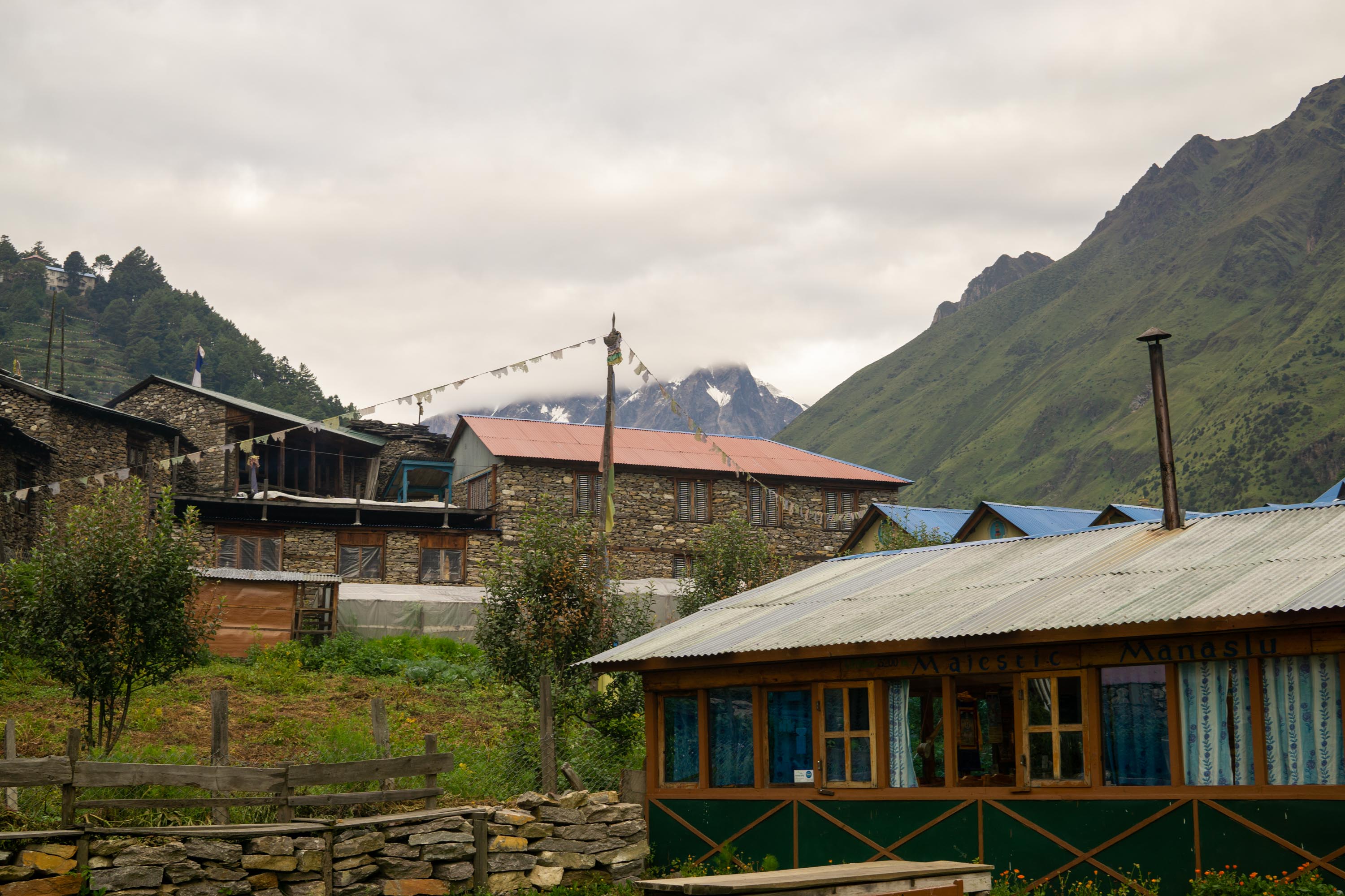
Ghap to Lho
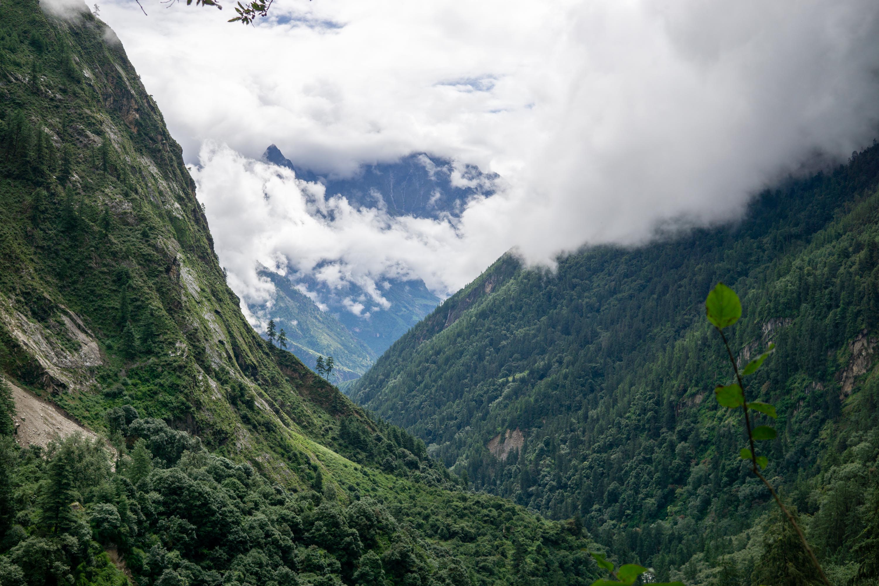
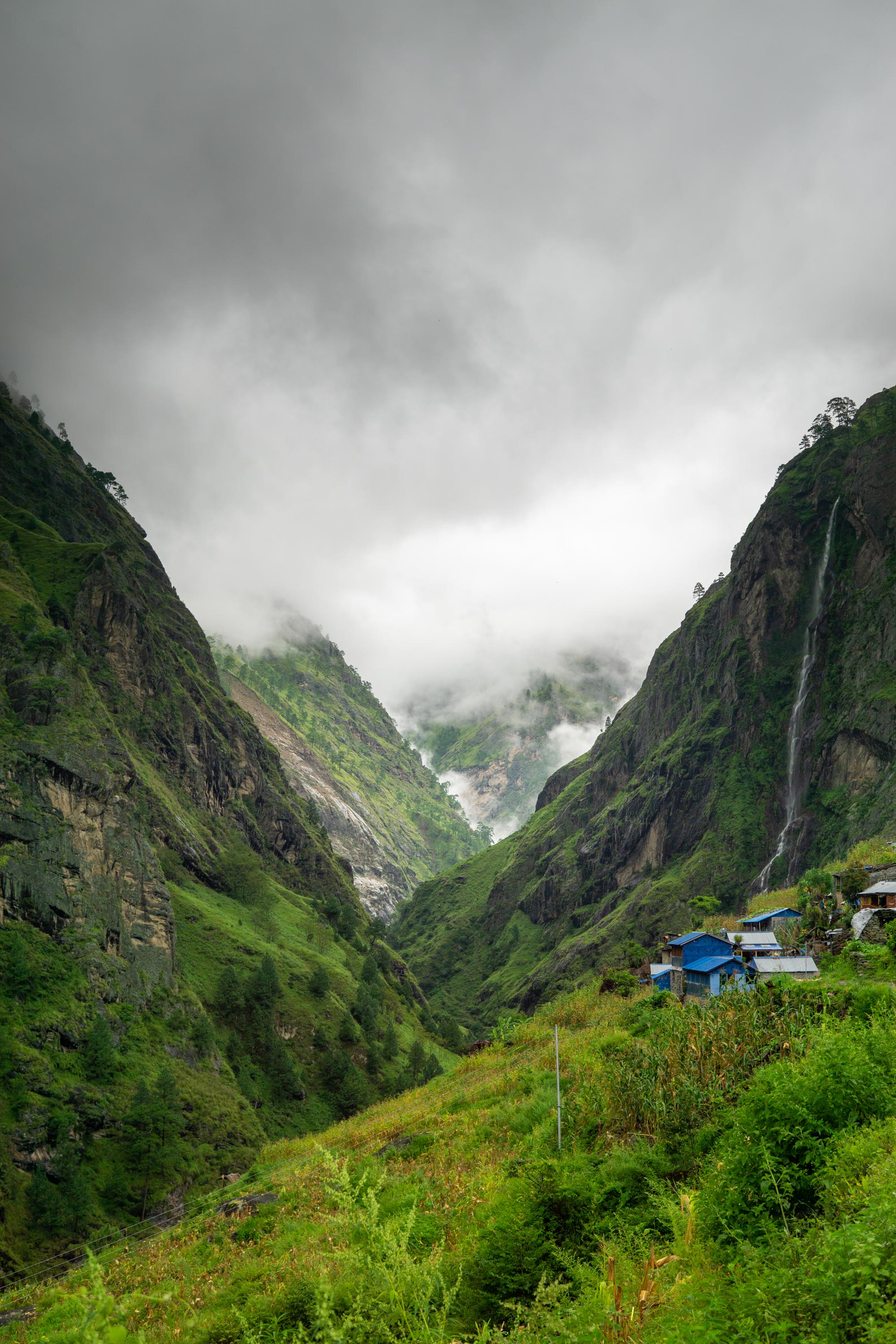
This day marked two clear transitions. The first transition was from a river valley into a glacial valley. The walk to Lho was a relatively steady uphill, with the last half mile or so rising 700 feet. The second transition was from the fields being rice to fields of wheat. The rain and clouds continued as they had the whole trip, but allegedly had it been clear, Lho offers the first view of Manaslu.
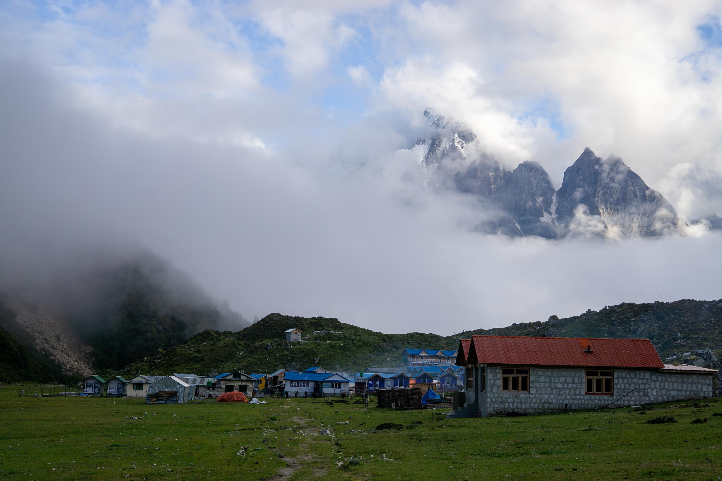
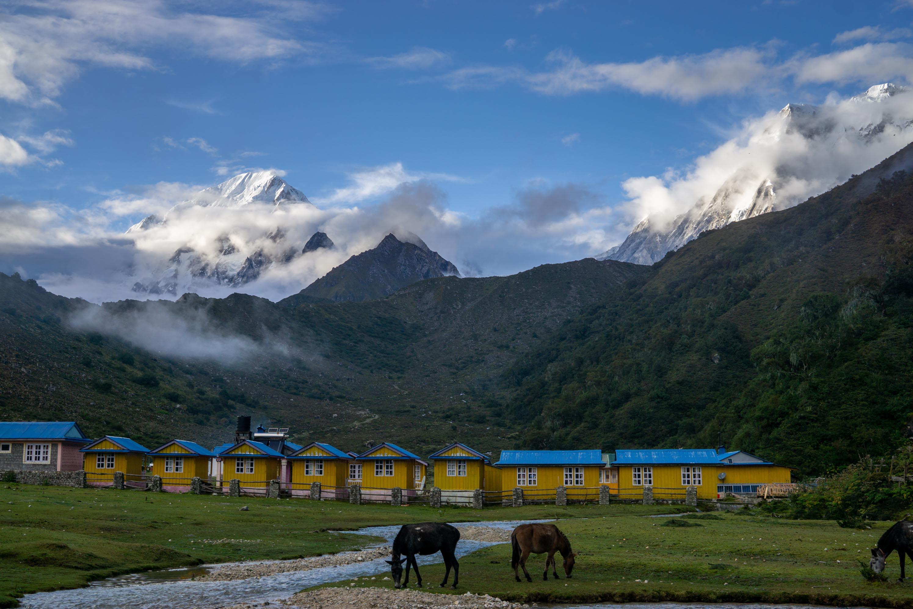
Shyala, Samaguan, and Samdo
I stayed in these three towns, all within about 6 miles of each other, for a day each to acclimatize before going over the pass. I was also feeling terribly under the weather at this point, and seriously contemplating turning around and going back the way that I had come. But the bus ride on the way out promised to be both shorter and paved, and by Samdo, more than 60% of the mileage was done.
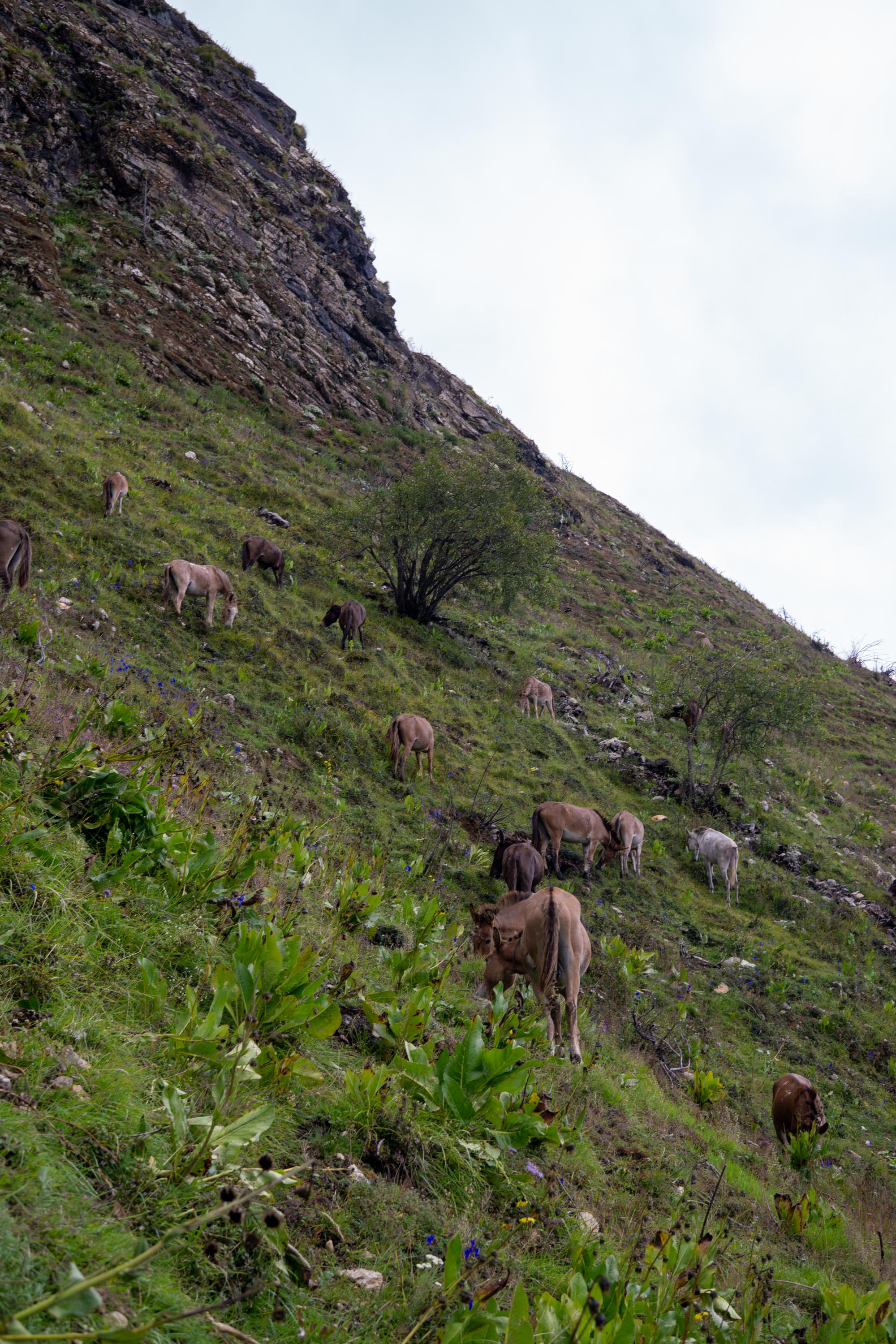
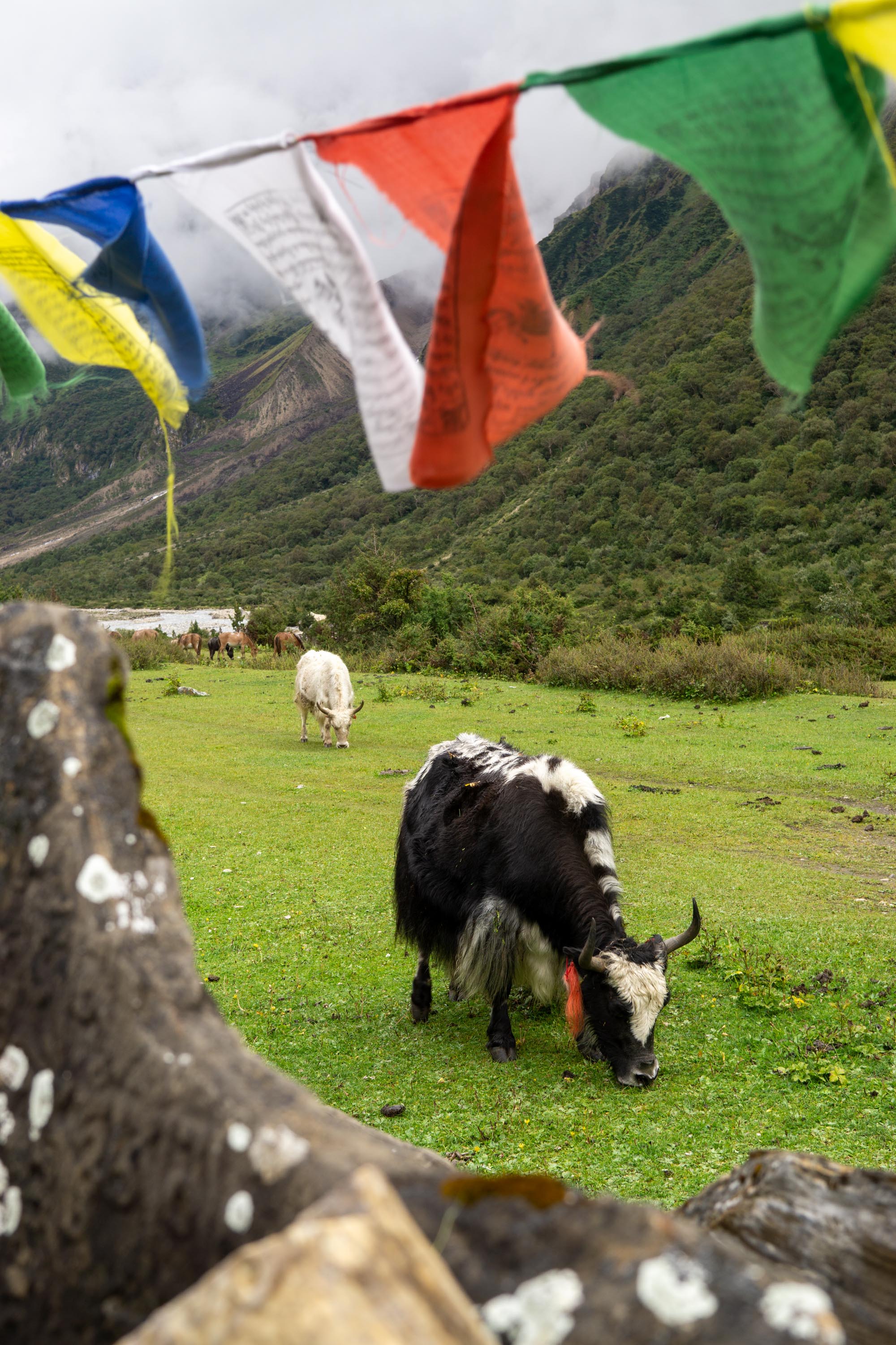
The towns them selves are all very close to Tibet, and in the traditional homeland of a Tibetan people. Even the domestic animals changed, from cows and donkeys to yaks and ponies.


Samdo to Bimthang
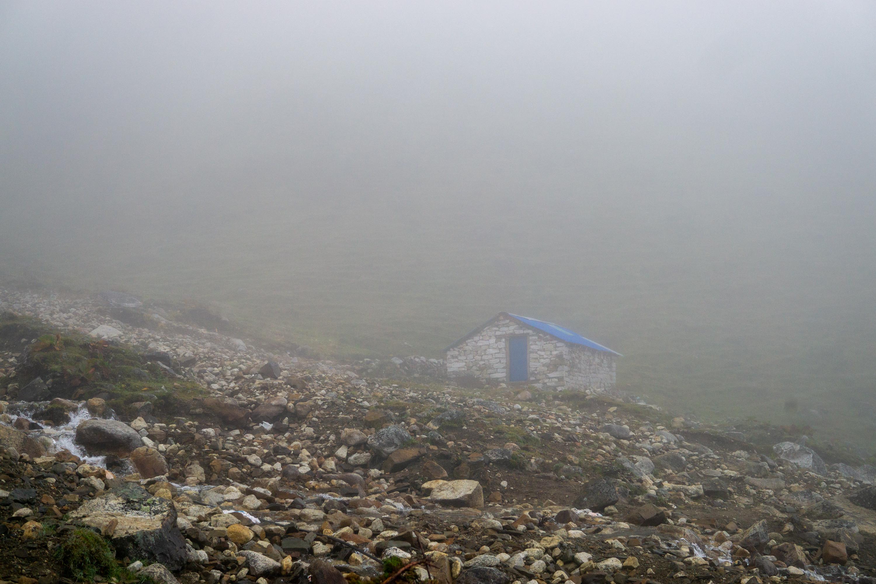
Started dark and early, we began walking at 4 AM to try and get over Larke pass before the winds picked up in the afternoon. For the first few hours, the hiking was dark and in a cloud which meant that everything – seen through the narrow cone of my headlamp – looked the same for hours on end. Samdo is at just above 12,000 feet and I stopped for the first time at about 6 am in Dharamshala, which is an outpost town at 14,500 feet that seems to exist only for trekking. I’d planned to get breakfast there, but the town seemed to have no one there, which meant no breakfast beyond a Snickers bar from Kathmandu.
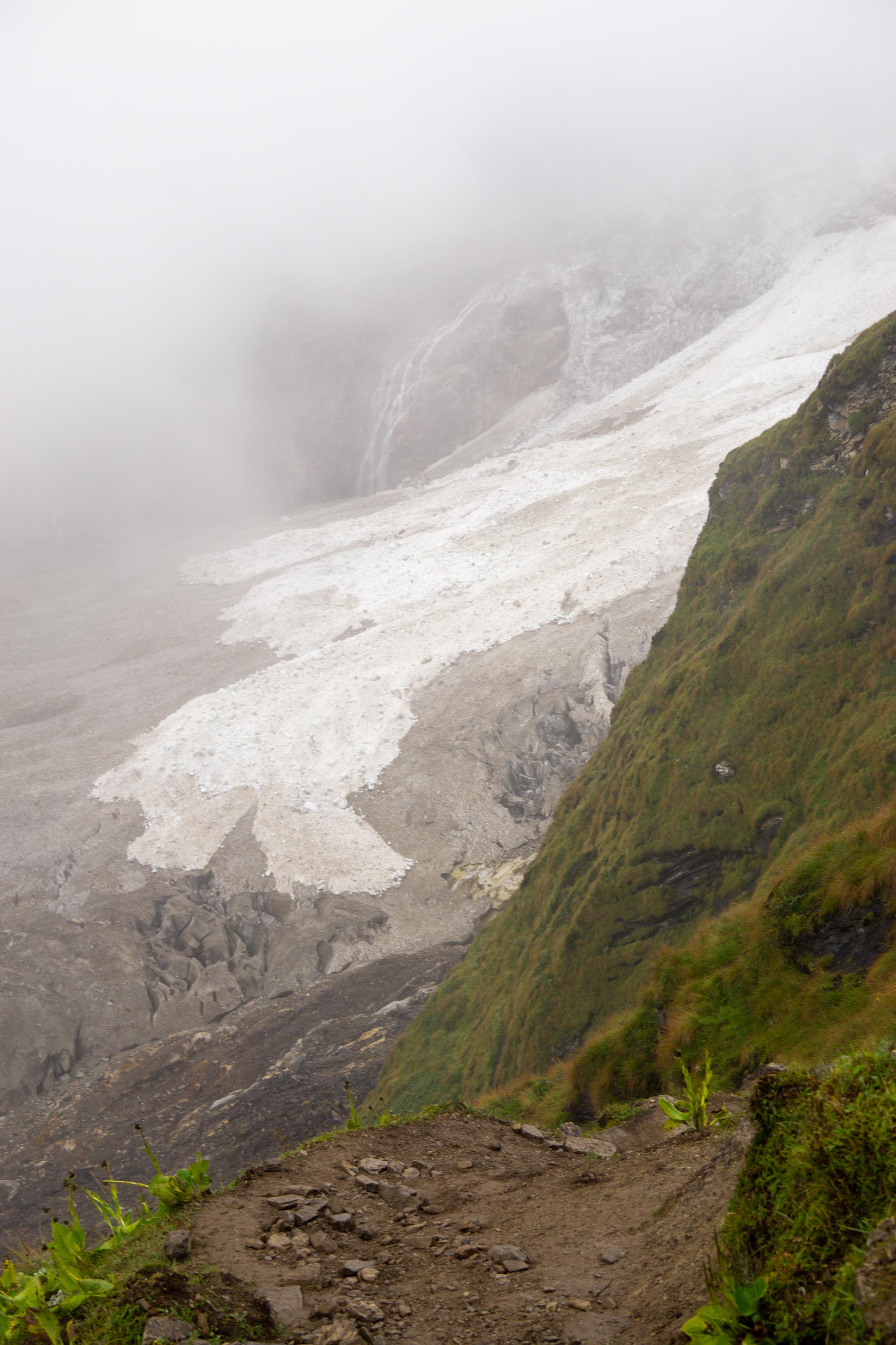
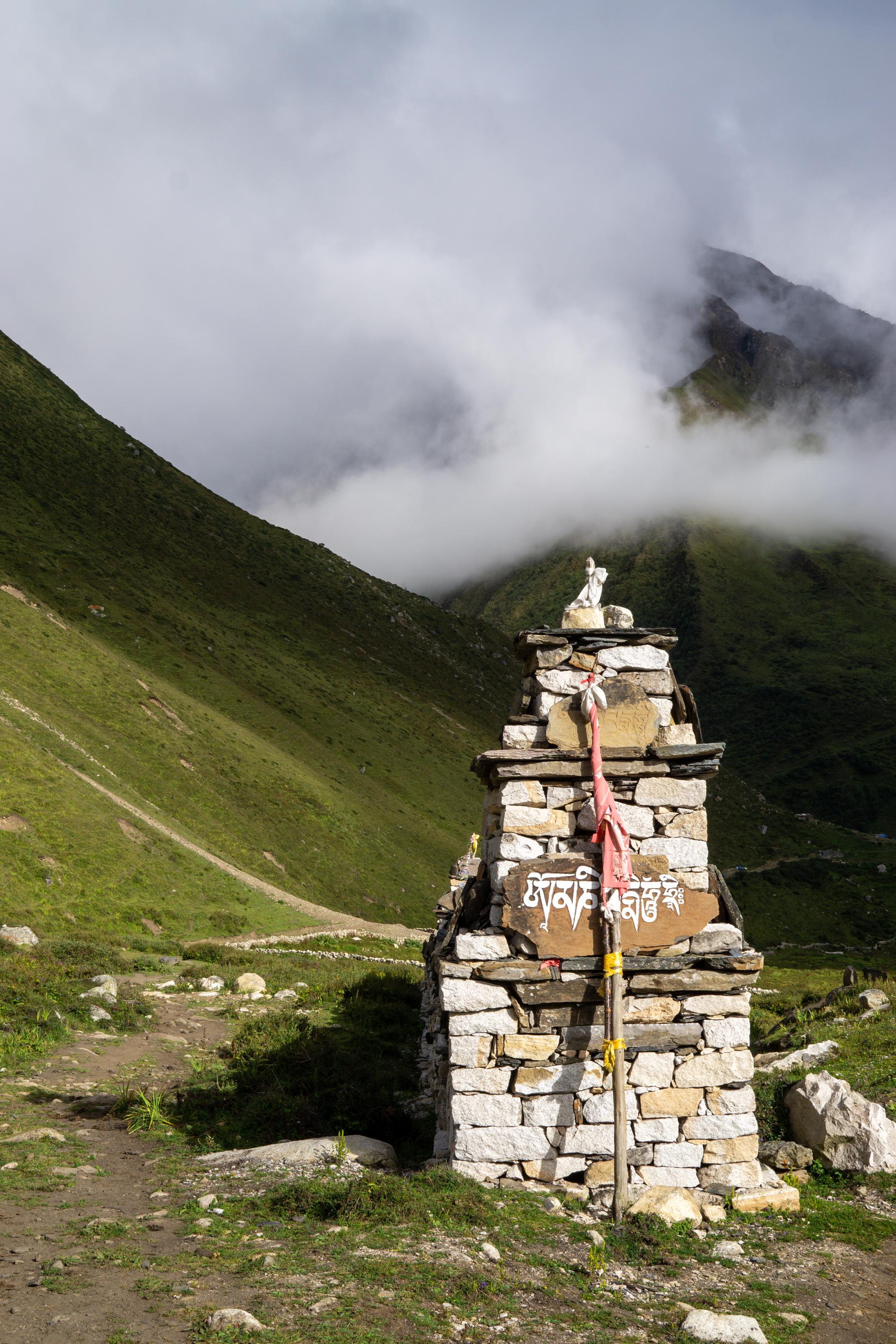
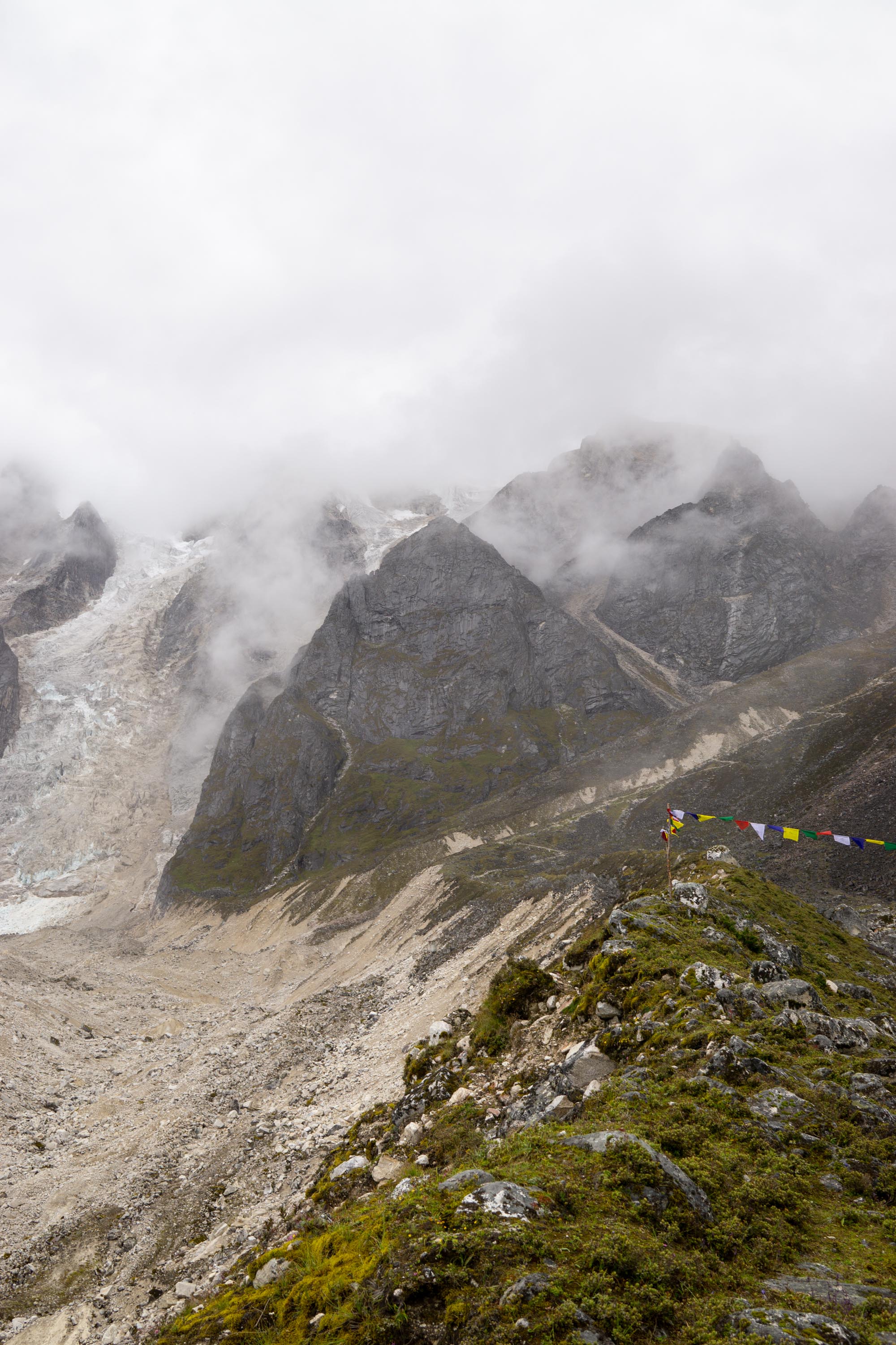
Larke pass is about 5 miles beyond Dharmashala, but perhaps the slowest 5 miles I have walked. It climbs steadily at about 500 feet per mile, but at that elevation, even the slightest uphill is quite noticeable. As I climbed to the top, the clouds turned into blowing wind and rain. They did not clear enough to make for a clear view. Near the top, I started to see mule trains that were coming from the other side of the pass beginning their descents. I stopped for a few minutes at the top of the pass itself and was pleasantly surprised with how quickly I went from huffing and puffing to being able to breathe again.
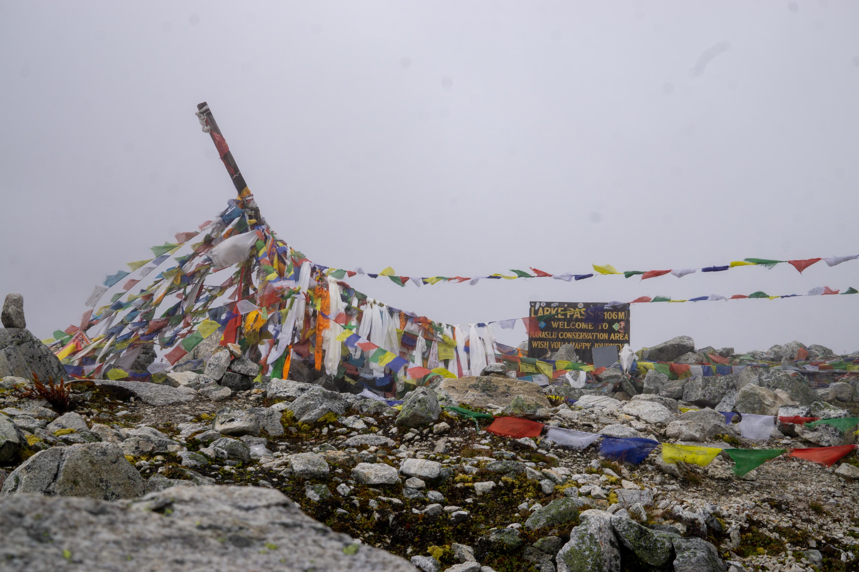
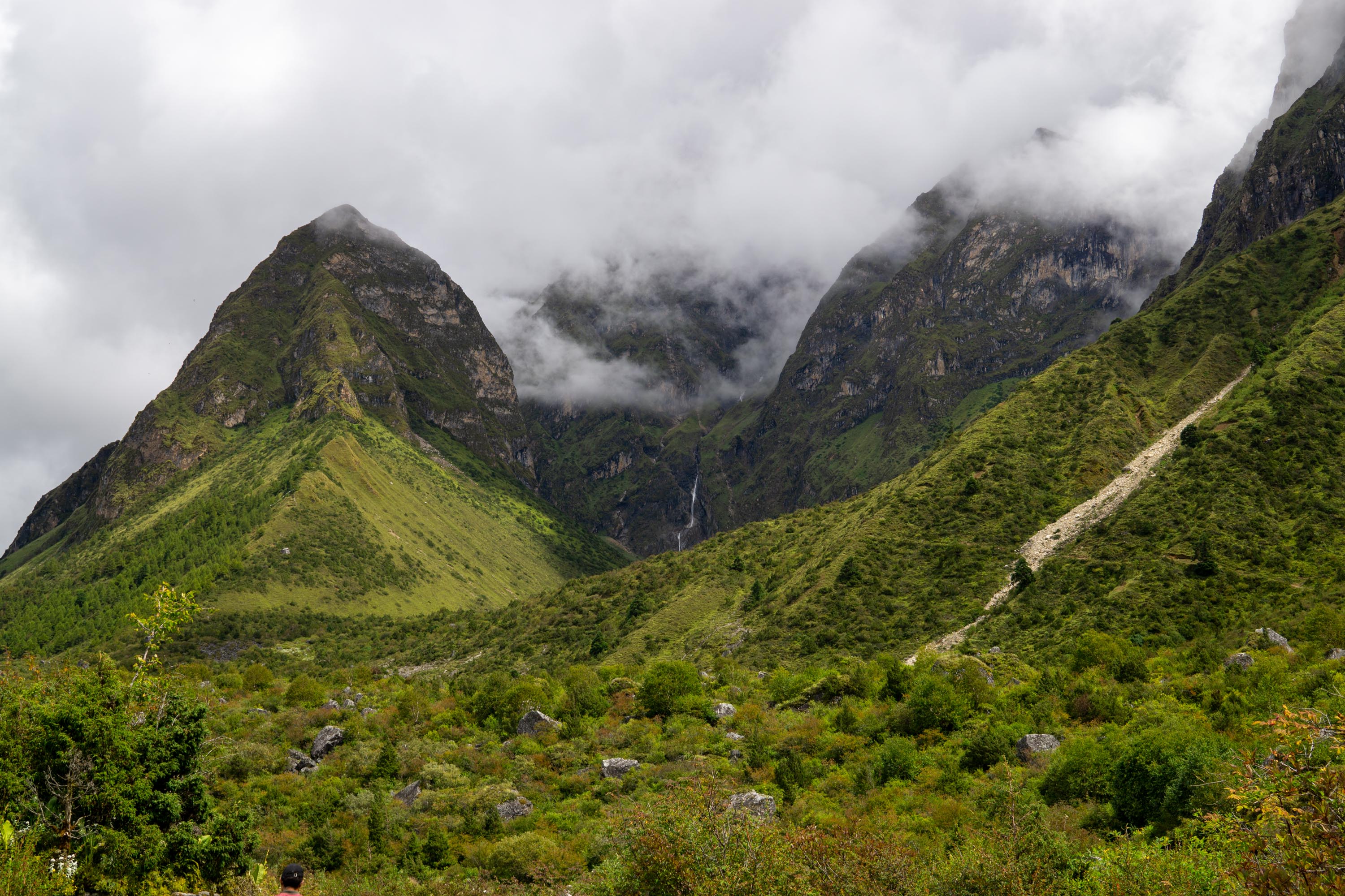
Though I only saw filtered views, the pass itself lies in a saddle between huge glaciers. I came from the east and went to the west, which is quite gradual, and the glacier is flowing horizontally. On the west side of the pass, there are hanging glaciers and the land feels much newer since the soil and rocks have not had a chance to settle. After another Snickers bar, the last of my schlepped stash, I started the descent into Bimthang.


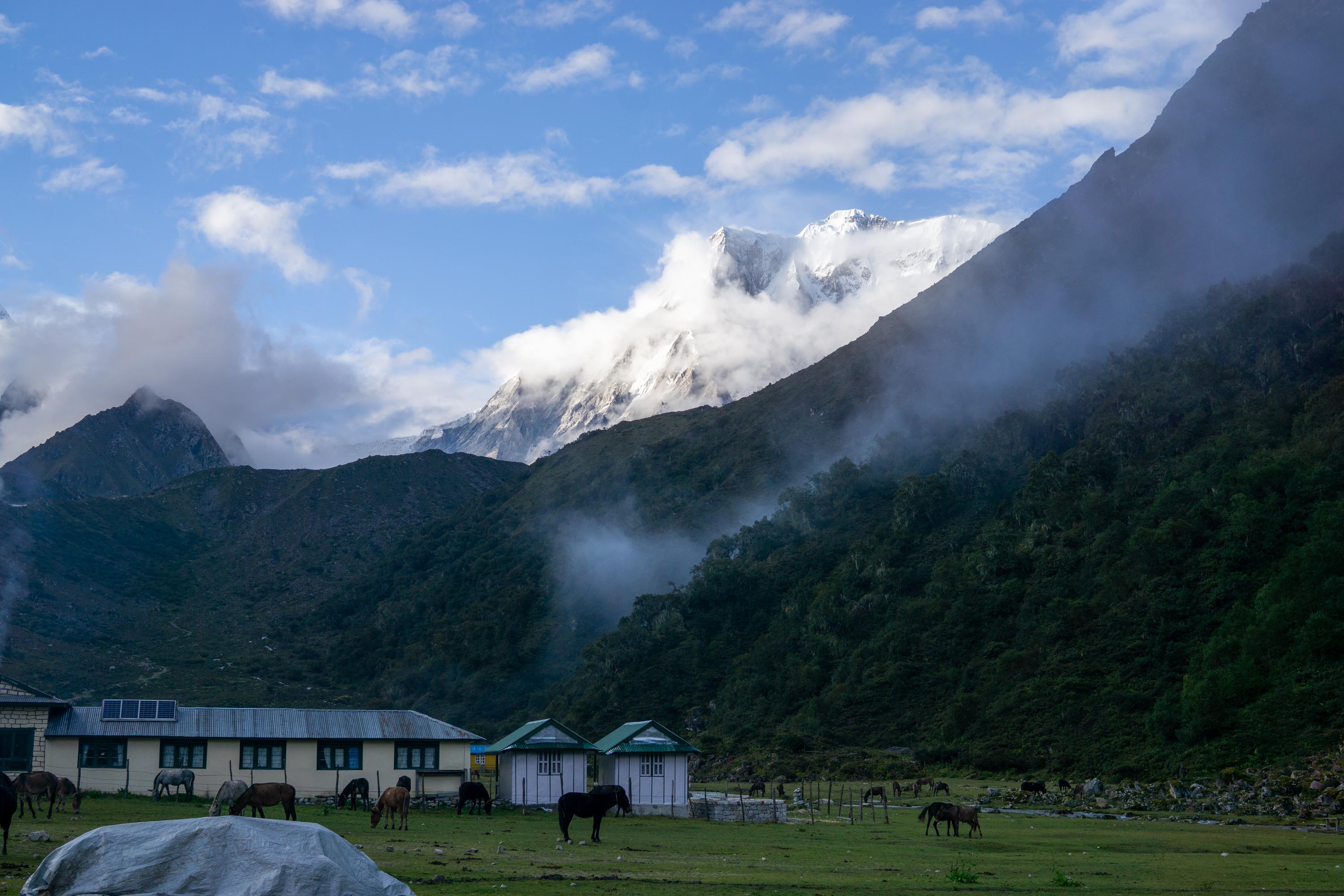
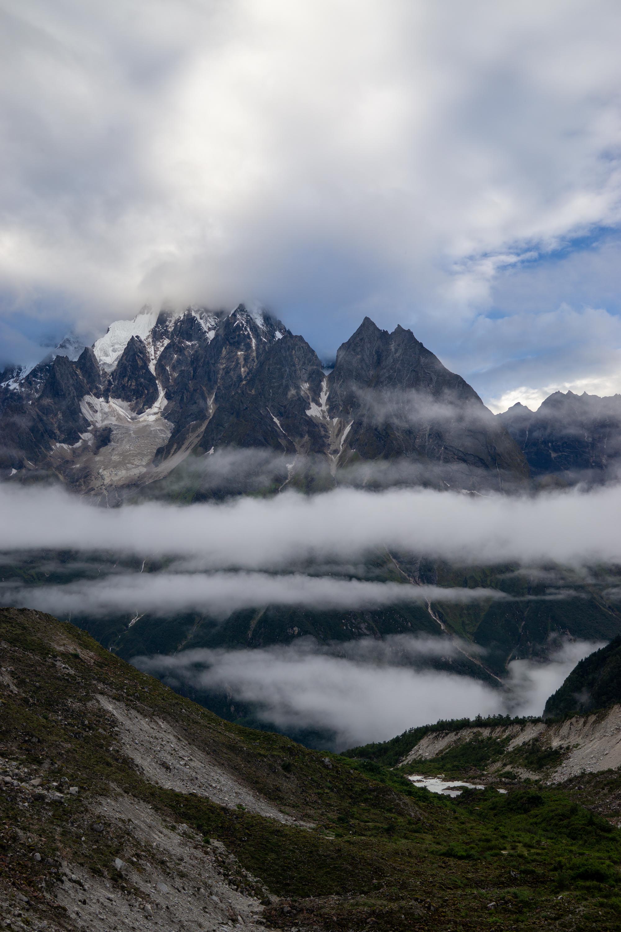
The clouds did not lift until lunchtime in Bihi, when the hanging glaciers on Larke peak and Manaslu’s west side poked their mouths into view. The sheer scale and potential energy of the rock and ice left me in awe. After the first meal of the day, I descended the last three miles into Bimthang, which is seated just before a huge terminal moraine in a grassy meadow. Shortly before sunset, the clouds finally cleared for a half hour revealing the true majesty of the high Himalayas. From Bimthang to the north I could see Larke peak (right) and Himal Chuli (left) and to the south, I could see Annapurna V and the bottom of Manaslu. However, a clear view of the top remained elusive as it had the entire trip to this point. I can see how people would love it here during the dry season when the views of the peaks are constant.

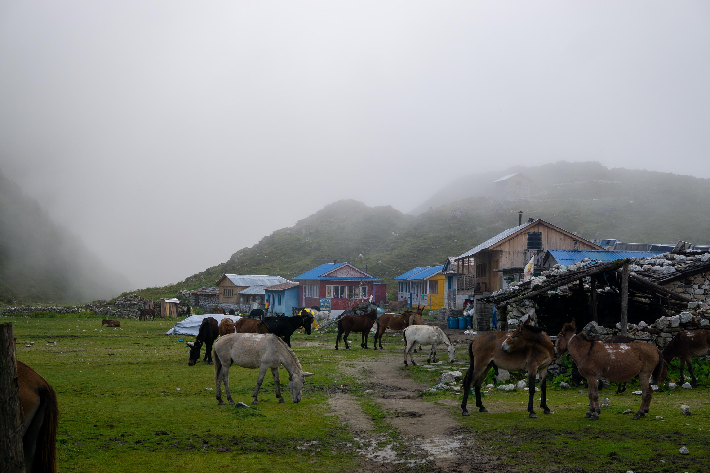
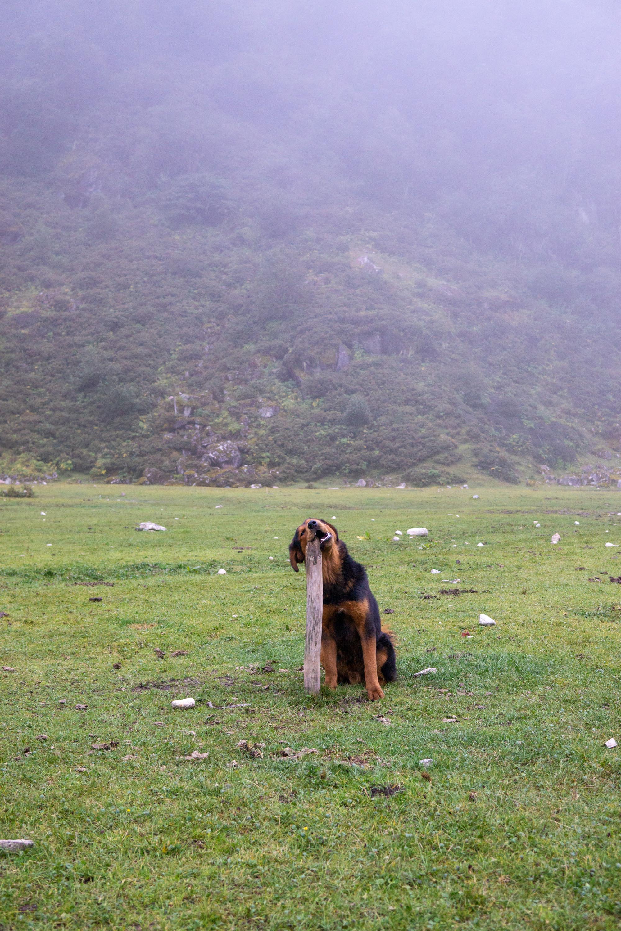
My night in Bimthang was not at all what I was expecting but in the best possible way. First off, the town was fenced in, which to me was curious. However, as mules began piling in (and I do mean piling, there were more mules than people in the town by at least a factor of three) it became clear to me that the fencing was to keep the mules contained. It was funny to watch their handlers take off each mule’s load, at which point the mules would uniformly bray with glee and role on their backs. The folks with whom I was staying invited me into their kitchen, which had a warm fire going. On top of the fire was a traditional still, which consisted of a pot of fermented rice and buckwheat, a smaller pot to catch the distillate, and bowl-shaped pot, filled with cool water, acting as a condenser. Their dog, whose name aptly translates to tiger, was both comical and adorable. There was an old hitching post that had been dug into the ground that Tiger was using as a toothbrush, and based on the wearing in it had been doing so for some time.
The next morning, just after the sun rose, Manaslu was the most visible that it had been the entire trip
Bimthang to Gho
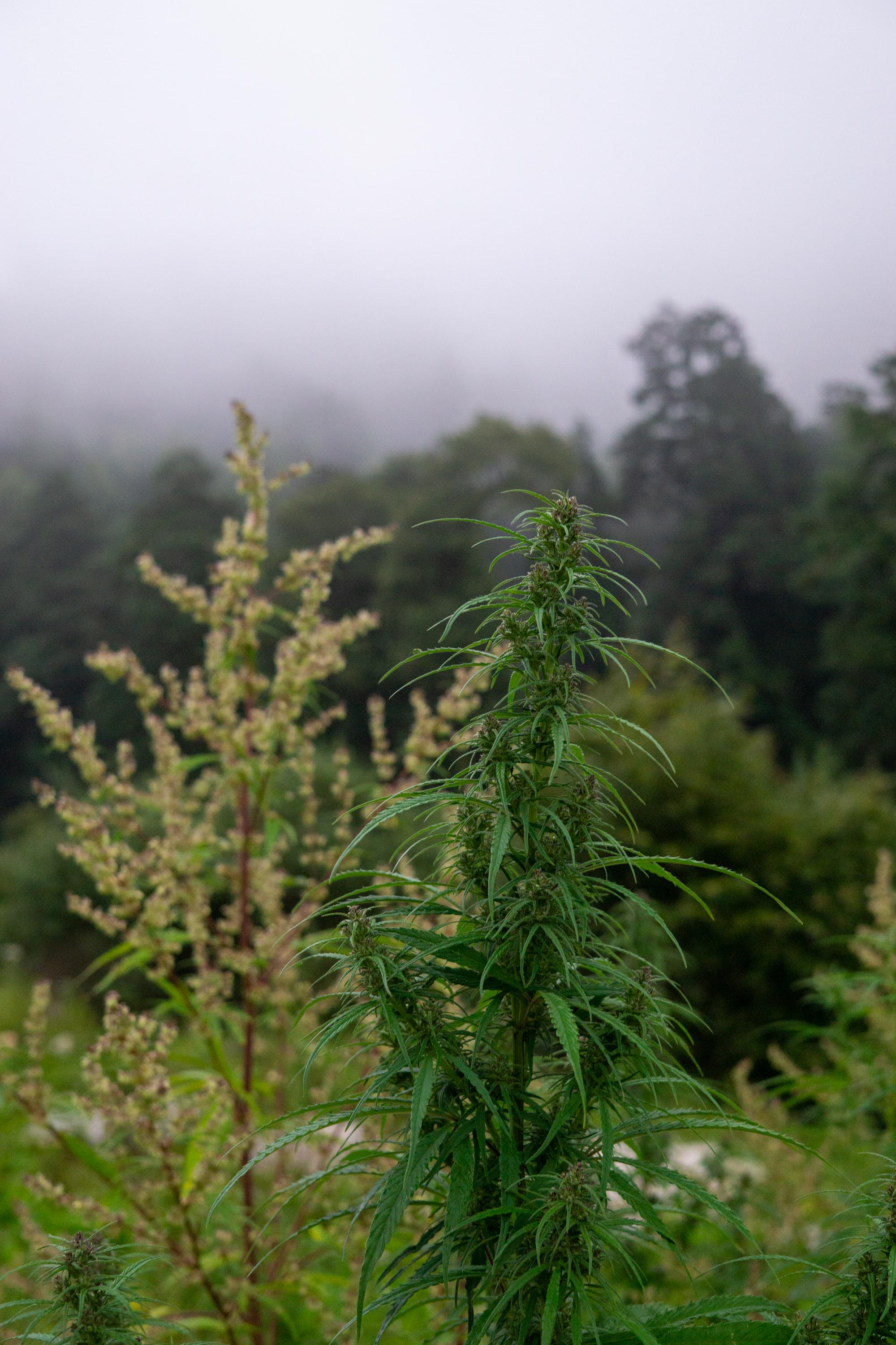
An easy day with no climbing and a ton of descending. We started solidly still in the low alpine and descended through the forest back into almost jungle. The trail was notably damper than when walking on the other side of Manaslu, partially because of the mules. I was happy to have boots that went over my ankles, but sometimes the mud threatened to go over them. As we were descending, there were a ton of mules coming up with oxygen supplies from Jagat bound for Manaslu. Again, stark to see the contrast between very rural areas with a ton of farming and mountaineering supplies. Gho was funny for two reasons, I met a group of climbers, including an Austrian guide schlepping a set of skis with plans to ski off the top of Manaslu – conceptually absolute insanity to me. The other funny part was right next to the trail there were a ton of pot plants- well within the native range, but it was funny to see such a vilified plant just hanging out in the wild. There were also more monkeys perched in the trees around the village, gray langurs.
Gho to Jagat
Walked the remaining 20 miles to Jagat where I would take a jeep ride to a bus back to Kathmandu the following day. The first 4 or so were spent on the same trekking trail that I had been, on before returning to a track and civilization in some form. At Dharpani, the track we were on turned into a full-on road as we met the Annapurna Circuit. The rest of the day was spent walking on the road. I shared the hotel that I stayed in with a group of Israeli tourists who were keeping Kosher, which the hotel’s kitchen was, somewhat surprisingly, quite happy to accommodate.
Getting Out
The following morning, we hitched a ride on a jeep for two and half hours (not including time spent fixing multiple flats). Then it was just a matter of enduring another, much smoother but much tighter, bus ride for a further seven hours on the 120 kilometers back to Kathmandu (impressively slow).
Reflections
All in all one of the more interesting things that I have done. I think there were many things that were more surprising than perhaps they should have been was the degree to which things are still manual in many parts of the world. Making gravel with a hammer is something that I had not ever considered. Everything that I ate, with a few exceptions for the snacks that I was carrying, was carried on a mule. And healthcare is either still from traditional healers, through traveling doctors and nurses, or outposts often staffed only by a community health worker. And in many ways, that these things are so surprising to me is in it itself a reflection of my upbringing. From a health perspective, which was admittedly not the main focus of this particular walk, I think it raised the question of whether can tourism help drive access to healthcare in a responsible way which was a new thought for me.